
Plik:Flag of Provence-Alpes-Côte d'Azur.svg

Wielkość pliku podglądu PNG dla pliku SVG: 800 × 533 pikseli Inne rozdzielczości: 320 × 213 pikseli | 640 × 427 pikseli | 1024 × 683 pikseli | 1280 × 853 pikseli | 2560 × 1707 pikseli | 1125 × 750 pikseli.
Rozmiar pierwotny (Plik SVG, nominalnie 1125 × 750 pikseli, rozmiar pliku: 55 KB)
| Plik Flag of Provence-Alpes-Côte d'Azur.svg znajduje się w Wikimedia Commons – repozytorium wolnych zasobów. Dane z jego strony opisu znajdują się poniżej. |
Opis
| Opis |
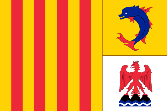
English: The flag of Provence Alpes-Cote-d'Azur |
| Data | |
| Źródło | Praca własna |
| Autor | Diades |
Licencja
Ja, właściciel praw autorskich do tego dzieła, udostępniam je na poniższej licencji
Ten plik udostępniony jest na licencji Creative Commons Uznanie autorstwa – Na tych samych warunkach 3.0.
- Wolno:
- dzielić się – kopiować, rozpowszechniać, odtwarzać i wykonywać utwór
- modyfikować – tworzyć utwory zależne
- Na następujących warunkach:
- uznanie autorstwa – musisz określić autorstwo utworu, podać link do licencji, a także wskazać czy utwór został zmieniony. Możesz to zrobić w każdy rozsądny sposób, o ile nie będzie to sugerować, że licencjodawca popiera Ciebie lub Twoje użycie utworu.
- na tych samych warunkach – Jeśli zmienia się lub przekształca niniejszy utwór, lub tworzy inny na jego podstawie, można rozpowszechniać powstały w ten sposób nowy utwór tylko na podstawie tej samej lub podobnej licencji.

|
Ta grafika przedstawia flagę, herb, pieczęć lub inne insygnia. Użycie takich symboli jest ograniczone w wielu krajach. Te ograniczenia są niezależne od praw autorskich. |
Historia pliku
Kliknij na datę/czas, aby zobaczyć, jak plik wyglądał w tym czasie.
| Data i czas | Miniatura | Wymiary | Użytkownik | Opis | |
|---|---|---|---|---|---|
| aktualny | 21:07, 18 sty 2014 | | 1125 × 750 (55 KB) | Superbenjamin | Better version |
| 16:13, 10 lip 2013 |  | 800 × 533 (74 KB) | Superbenjamin | Pbm | |
| 17:50, 18 maj 2013 |  | 900 × 600 (1 KB) | Superbenjamin | Version SVG | |
| 16:25, 28 sty 2013 |  | 800 × 533 (74 KB) | Superbenjamin | proportions correctes | |
| 12:19, 3 maj 2012 |  | 1000 × 581 (25 KB) | Diades | updated file | |
| 12:06, 3 maj 2012 |  | 1000 × 581 (24 KB) | Diades | Updated file to correct background | |
| 01:30, 3 maj 2012 |  | 1000 × 581 (24 KB) | Diades |
Lokalne wykorzystanie pliku
Z tego pliku korzysta więcej niż 100 stron. Poniższa lista pokazuje jedynie 100 pierwszych z nich. Dostępna jest również pełna lista.
- Aiglun (Alpy Górnej Prowansji)
- Aix-en-Provence
- Allemagne-en-Provence
- Allons (Alpy Górnej Prowansji)
- Allos
- Angles (Alpy Górnej Prowansji)
- Annot
- Antibes
- Archail
- Aubenas-les-Alpes
- Aubignosc
- Authon (Alpy Górnej Prowansji)
- Auzet
- Awinion
- Banon
- Barcelonnette
- Barles
- Barras
- Barrême
- Bayons
- Beaujeu (Alpy Górnej Prowansji)
- Beauvezer
- Bellaffaire
- Bevons
- Blieux
- Bras-d’Asse
- Braux (Alpy Górnej Prowansji)
- Brunet
- Cannes
- Castellet-lès-Sausses
- Champtercier
- Chaudon-Norante
- Château-Arnoux-Saint-Auban
- Châteaufort (Alpy Górnej Prowansji)
- Châteauneuf-Miravail
- Châteauneuf-Val-Saint-Donat
- Châteauredon
- Clamensane
- Claret (Alpy Górnej Prowansji)
- Clumanc
- Colmars
- Corbières-en-Provence
- Cruis
- Curbans
- Curel (Alpy Górnej Prowansji)
- Céreste
- Dauphin (Francja)
- Demandolx
- Digne-les-Bains
- Draix
- Enchastrayes
- Entrages
- Entrepierres
- Entrevaux
- Entrevennes
- Esparron-de-Verdon
- Estoublon
- Faucon-de-Barcelonnette
- Faucon-du-Caire
- Fontienne
- Forcalquier
- Francja
- Ganagobie
- Gigors
- Gréoux-les-Bains
- Jausiers
- La Brillanne
- La Bréole
- La Condamine-Châtelard
- La Garde (Alpy Górnej Prowansji)
- La Javie
- Lambruisse
- Larche (Alpy Górnej Prowansji)
- Lardiers
- Le Brusquet
- Le Caire
- Le Castellard-Melan
- Le Castellet (Alpy Górnej Prowansji)
- Le Chaffaut-Saint-Jurson
- Le Fugeret
- Le Lauzet-Ubaye
- Les Mées (Alpy Górnej Prowansji)
- Lista regionów i departamentów Francji (1982–2015)
- Lourmarin
- Lurs
- L’Escale
- L’Hospitalet
- Majastres
- Malijai
- Mallefougasse-Augès
- Mallemoisson
- Mane (Alpy Górnej Prowansji)
- Manosque
- Marcoux (Alpy Górnej Prowansji)
- Marsylia
- Méailles
- Nicea
- Olympique Marsylia
- Orange (Vaucluse)
- Prowansja-Alpy-Lazurowe Wybrzeże
Pokaż więcej odnośników do tego pliku.
Globalne wykorzystanie pliku
Ten plik jest wykorzystywany także w innych projektach wiki:
- Wykorzystanie na af.wikipedia.org
- Wykorzystanie na als.wikipedia.org
- Elsass
- Korsika
- Benutzer:Stephele/coffre fort
- Vorlage:Navigationsleiste Französische Regionen
- Bretagne
- Réunion
- Regionen Frankreichs
- Burgund
- Aquitanien
- Lothringen
- Mayotte
- Guadeloupe
- Martinique
- Franche-Comté
- Normandie
- Vorlage:Info ISO-3166-2:FR-U
- Grand Est
- Auvergne-Rhône-Alpes
- Neu-Aquitanien
- Hauts-de-France
- Bourgogne-Franche-Comté
- Region Okzitanien
- Nizza
- Centre-Val de Loire
- Île-de-France
- Pays de la Loire
- Provence-Alpes-Côte d’Azur
- Französisch-Guayana
- Marseille
Pokaż listę globalnego wykorzystania tego pliku.